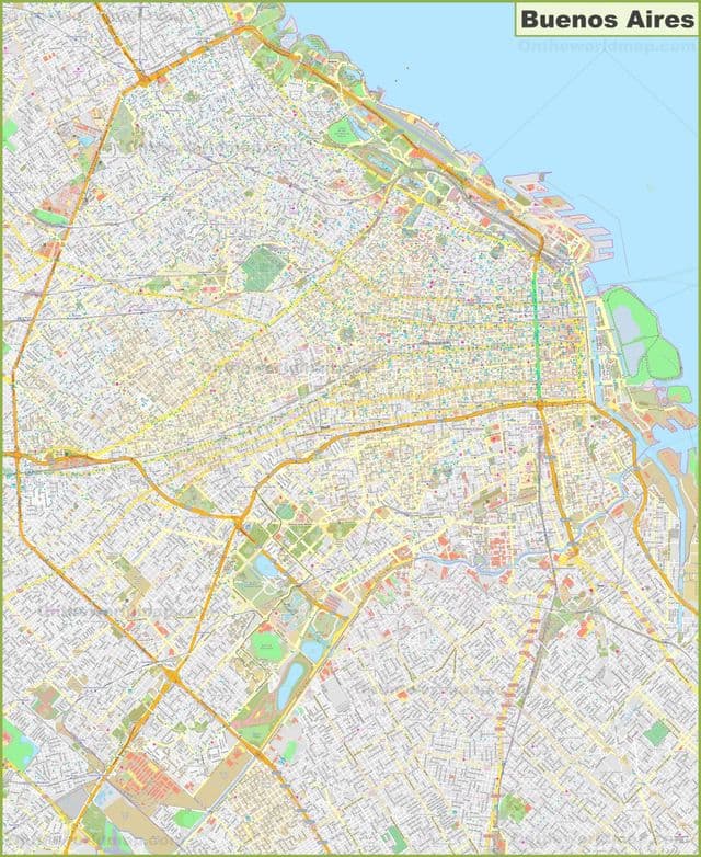
Buenos Aires streets map
You can find on this page the Buenos Aires streets map to print and to download in PDF. The Buenos Aires roads map presents the road network, main roads, routes and motorways of Buenos Aires in Argentina.
Buenos Aires streets map
The Buenos Aires streets map shows all street network and main roads of Buenos Aires. This streets map of Buenos Aires will allow you to find your routes through the streets of Buenos Aires in Argentina. The Buenos Aires streets map is downloadable in PDF, printable and free.
Florida is the most pedestrian, commercial and lively street in Buenos Aires. Nearly a million people (workers and tourists) walk up and down Florida every day. It is located in the Microcenter as you can see in Buenos Aires streets map, the business district, and the best time to visit is around 3:00 PM. Here you will find all sorts of shops: the great stores like Falabella, exchange houses, shoe stores, leather goods stores, computer stores, souvenir shops, clothing boutiques, and eateries. Besides, you can watch spectacles “a la gorra” when you visit Florida (music, tango dancers, magicians and fakirs, living statues, as well as art and diverse objects for sale on the street).
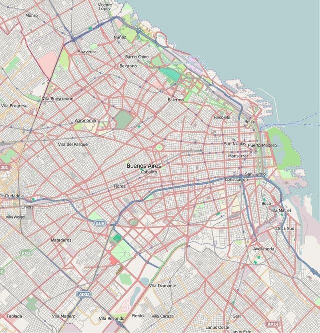
Buenos Aires roads map
The Buenos Aires roads map shows all road network and highways of Buenos Aires. This roads map of Buenos Aires will allow you to find your routes through the roads and motorways of Buenos Aires in Argentina. The Buenos Aires roads map is downloadable in PDF, printable and free.
Most Buenos Aires city traffic is regulated by automatic traffic lights, the city residents are notorious for ignoring them. For many years, two major roads, Calle Florida and Calle Lavalle as you can see in Buenos Aires roads map, were traditionally closed to motor traffic during part of the day to allow for a free flow of pedestrians. Now, however, Calle Florida is reserved for pedestrians at all times. Traffic-calming measures, such as speed bumps and closed roads, have been proposed as a means of controlling noise, pollution, and congestion in many neighbourhoods, but as of the early 21st century little progress had been made in implementing these measures.